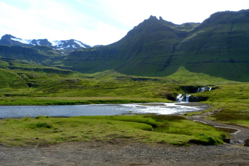
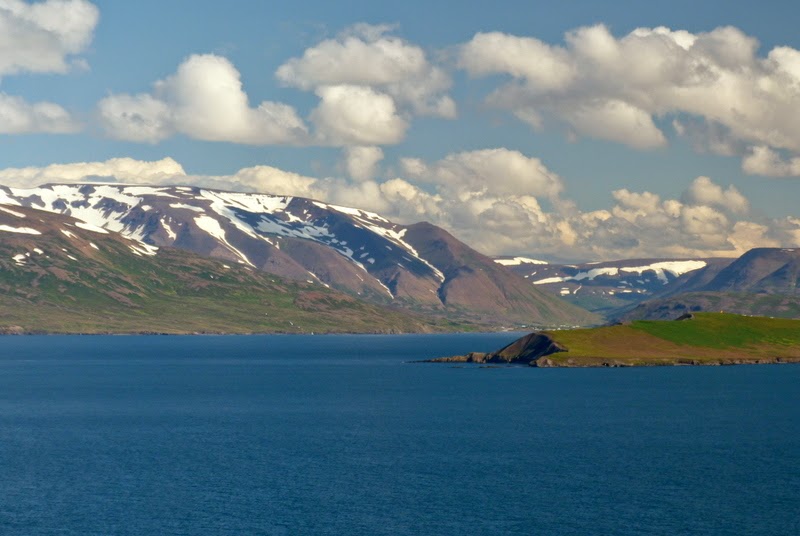
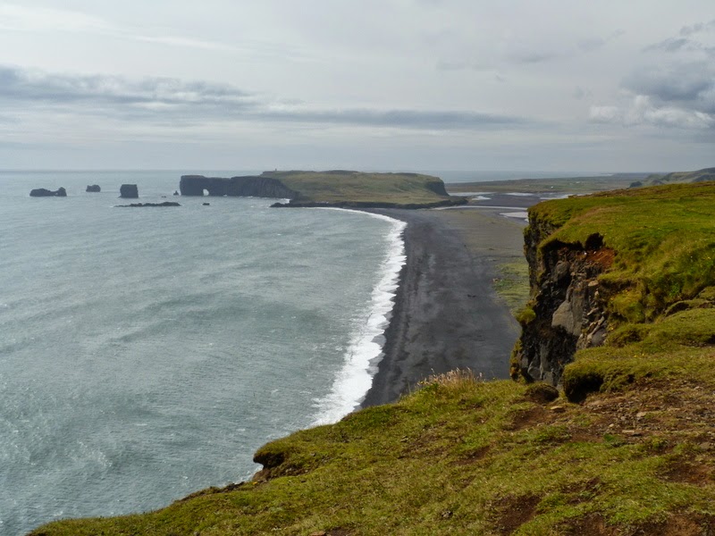
Iceland
is a small volcanic island located between the Arctic Ocean and the North
Atlantic. It has the world’s longest
life expectancy, the best free education (99% literacy rate), and the world’s largest
hot tub. With a population of just over
300,000 people, it is the most sparsely populated country in Europe. Four-fifths of the country is unpopulated and
uninhabitable. The island is
volcanically and geologically active - characterized by lava fields, lakes and
rivers, lush green areas, mountains, glaciers, natural hot springs, waterfalls,
and volcanoes. It is a spectacle of
nature, an incredibly diverse landscape, a magical place to visit.
We traveled here July 27-August 7, 2014, with Overseas Adventure Travel and friends Dennis and Vicky Shepard, Jo Wilson, Carol Bennett, Doris Coward and Debbie Volker.
REYKJAVIK
The
city of Reykjavik dates to 871AD, when the Norwegian Viking Ingolfur Arnarson,
the country’s first permanent inhabitant, made his home here. Growth was slow until the establishment of
the woolen and fishing industries in the 18th and 19th century. Today Iceland’s capital city
has just over 200,000 residents – two-thirds of the country’s entire
population.

Old Reykjavik is the heart of the city, anchored by Tjornin, a pretty lake loaded with birds and surrounded by parks and nice houses. The modern Town Hall (Raohus) sits on the lake shore, and nearby is the Unknown Official - a sculpture honoring (?) the thankless, anonymous job of the bureaucrat.

The
town square is home to Alpingishús (Parliament House), an 1880 stone building erected when the
Parliament was moved here from its original home at Thingvellir. Adjacent to the Parliament House is the
simple but elegant Dómkirkjan (City
Cathedral), the Lutheran church where national independence received its
first religious blessing.

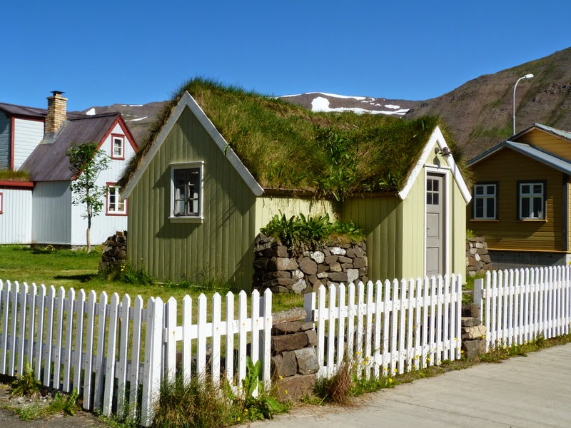
The oldest house in Reykjavík was built in 1762. Over the years, it has been home to a number of famous Icelanders; today it is home to an Icelandic craft shop. Newer homes in the central city didn't look so very different!
For
more about Iceland’s national heritage, the
National Museum of Iceland traces Iceland’s history from the Settlement to
the present day. Among its 300,000
artifacts and 4 million photographs, two of the most interesting exhibits were a
small statue and an old Bible. The
statue dates to 1000 AD and is thought to represent Thor, one of the major
Norse gods. The Bible, printed in 1584,
was the first translation of the entire Bible printed in Icelandic – this copy
still has its original binding!

The
city’s tallest building, Hallgrimskirkja,
is also the tallest church in the country.
The church’s dramatic design was quite controversial when it was first
built (1974), but it’s now a major landmark visible for miles around the
city. In
front of the church is a statue of the Viking Leif Eriksson, the first European to discover America. The statue was a gift from the U.S. on the
1000th anniversary of Iceland’s National Assembly.

 Near
the harbor, the Harpa is Reykjavik’s
sparkling new concert hall. The
structure consists of an intricate steel framework fitted with geometric shaped
glass panels of different colors. The glass façade covers the entire
building and reflects both sky and harbor – its appearance changes
continuously. Like it or hate it, it is
dazzling - inside and out!
From
the sublime to the ridiculous, Harpa is also the neighborhood of Reykjavik’s
most famous (and most favorite) restaurant, Baejarins Beztu Pylsur.
Well, maybe ‘restaurant’ is a big much for this red-and-white hot dog
stand, but this one is a Reykjavik institution.
There’s a line regardless of the hour or the weather. An Icelandic hot dog comes with fried onions,
raw onions, ketchup, remoulade sauce and sweet Icelandic mustard. Cheapest meal on the island!

Also
near the Harpa are several of Reykjavik’s many fascinating statues and abstract
monuments. One is a ship-like sculpture
known as Sun-Craft; another is small
grass-covered hill known as Pufa. Both command great views of the city and the
harbor.

Perlan (The
Pearl) is another of Reykjavik’s high spots. Overlooking the city, this museum,
dining, and entertainment complex sits on top of six big thermal water tanks,
each one holding one million gallons of water.
There is a viewing deck encircling the dome, with panoramic views of the
city and the mountain range and ocean surrounding it.
Our hotel in Reykjavik was some distance from city center, in a more residential area with plenty of parks and gardens for walking. We visited Laugardalshöll, the Reykjavik Botanical Garden, and the Sveinsson Museum of Sculpture.
Laugardalshöll
is a huge sports complex with indoor facilities for
every sport known to mankind. Perhaps
the most famous event held here was the World Chess Championship of 1972, in
which American challenger Bobby Fischer defeated the Russian champion Boris
Spassky.
The Reykjavik Botanical Garden contains over
5000 varieties of sub-arctic plant species, lots of colorful flowers, bird life
and interesting sculptures. This
sculpture of a woman washing clothes relates to the history and geology of the
park, which is in an area known as ‘Hot Springs Valley.’ This was the place where women came to wash
clothes, taking advantage of the steamy geothermal pools that provided an easy
source of hot water.

The Asmundur Sveinsson Museum of Sculpture is
dedicated to one of the pioneers of sculpture in Iceland. Sveinsson found his inspiration in the
Icelandic landscape, literature, and people. His works praise the Icelandic
common people, folktales and nature.

AROUND REYKJAVIK
Hafnarfjordur
is a suburb of Reykjavik known for its annual Viking Festival and for its large
settlement of Hidden Folk.
Many Icelanders believe that their country is populated by hidden races of
little folks – gnomes, elves, fairies, dwarves, and more. Many Icelandic gardens feature small wooden
elf houses … just in case the myths are true.
Hafnarfjordur lies at the confluence of several strong lines of mystical
energy and seems to be the home of a parallel elfin universe. We visited Hellisgerði, a charming park filled with lava grottoes – it is said
to be one of the favorite places of the hidden people, but we didn’t spot a
single one!
South
of the capital is the Blue Lagoon,
Iceland’s world famous spa, renowned for its healing power. Set in an ancient lava field, the milky-blue
lagoon is fed by water from a geothermal power plant. The silver towers of the plant provide a
curious backdrop for a spa, but then they’re barely visible through the clouds
of steam rising from the water.

The superheated sea water is rich in blue-green algae, mineral salts and fine silica mud, which condition and exfoliate the skin. People smear more mud on their faces for extra impact. The temperature ranges from 99 to 102 degrees; after a couple of hours, you come out warm to the core and soft as a baby’s butt. Like all Icelandic swimming pools, the Blue Lagoon requires naked pre-pool shower and shampoo!

West
of Reykjavik is the Golden Circle, a
collection of interesting sights that make for a nice day trip from the
capital. There’s no historical or
geological connection among these spots – they’re just conveniently located on
a nice loop drive.
Pingvellir is
one of Iceland’s most important historical sites, a sacred site for all
Icelanders, and the first place in Iceland to be named a UNESCO World Heritage
Site. The Alpingi, or Icelandic
Parliament, was founded here in 930 AD and assembled each summer until 1264 AD
when Iceland came under rule of Norway.
The
Alpingi was both a legislative and judicial assembly; it held supreme authority
of the country. Many crucial events in
Iceland’s history took place here at the Law Rock, including the adoption of Christianity.
The natural environment here is unique. Pingvellir Lake is Iceland’s largest lake. Pure glacial water filters through bedrock to enter the lake, where it is joined by hot springs spouting from beneath the lava field on the other side. Its waters are full of Arctic char that have been isolated for so long that they have evolved into four subspecies (all very tasty).
 Near
the lake is Pingvallabaer, a
farmhouse built for the 1000th anniversary of the Alpingi, and Pingvallakirkja, one of Iceland’s first
churches. The original structure dates
back to the 11th century.
Pingvellir Lake fills much of the basin formed by the Great
Atlantic Rift that runs through Iceland from the southwest to the
northeast. Above the lake is a dramatic
example of the rift between North America and Europe – we walked the trail that
slices through the earth.
Geysir is the original hot-water spout after which all other geysers around the world are named. The Great Geysir once sent water some 250 feet into the air, but stone blockages have made its eruptions erratic. Fortunately, the world’s most reliable geyser, Strokkur, is right next door – every few minutes, it sends a plume of water 100 feet in the air. Both geysers are part of a large geothermal field with at least 30 hot springs and bubbling pools.
Gullfoss (Golden Waterfall) is Iceland’s most famous waterfall, a spectacular double cascade on the glacial river Hvita. It drops over 100 feet, sending up waves of spray, and then thunders another 100 feet into a narrow ravine. The falls came close to destruction in the 1920s when a team of foreign investors wanted to build a hydroelectric plant here. A local woman campaigned tirelessly to save the falls; she walked barefoot to Reykjavik and threatened to throw herself into the falls – we are grateful for her efforts. It’s a beautiful place - for the falls themselves and for the distant view of the huge glacier Langjokull.

Faxi waterfall is a wide, but much smaller version of Gullfoss. It is located on another glacial river, Tungufljót, and has a fish ladder adjacent to it. Nearby is a sheepfold, where every fall sheep are herded from the highlands and sorted for the owners to take them to market.
WESTERN ICELAND


Borgarnes is a small fjord-side town that is home to one of Iceland’s best museums. In a restored warehouse, the Settlement Center covers the history of Iceland from the time of its discovery and settlement – how the land was discovered, how the Vikings conquered the open ocean and why they left the homelands in Norway.
Nearby
is Hraunfossar, where a series of
waterfalls pour over the side of the Hvita River canyon from underneath a huge
lava field. This type of lava is known
as pillow lava; it is believed to have formed in about 800 AD. The local name for this place is Magic
Waterfalls, as the water seems to appear magically from under the rock.

The small town of Reykholt is pretty place to visit, but there’s lots of history here, too. This was the home of Snorri Sturluson (1178-1241), Iceland’s best known author, poet and scholar. Snorrastofa is a study center devoted to the work of this medieval historian.
On-site there is a small church and a cemetery said to be the burial place of Snorri himself. Inside the church there is beautiful stained glass and an old baptismal font.
Nearby is an ancient thermal pool, named Snorralaug, Snorri’s pool. A wood-paneled tunnel leads to the site of the old farmhouse and it is believed that this is where Snorri came to bathe. The pool is the oldest manmade structure in Iceland.
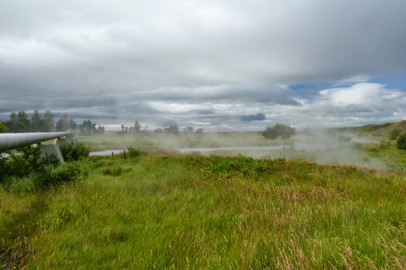
Not far from Storri’s place is Deildartunguhver, Europe’s biggest hot spring – producing about 45 gallons of water per second. Billowing clouds of steam rise up as scalding water bubbles up from the ground. Hot water is piped for heating three coastal towns some 50 miles away.
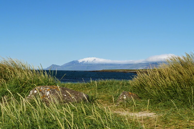
Heading
northwest, we get our first view of Snæfellsjökull, a 700,000-year-old
volcano with a glacier covering its summit.
It is located on the most western part of the Snaefellsnes peninsula,
where we are headed. This mountain is
one of the most famous sites of Iceland, thanks to the novel Journey to
the Center of the Earth by Jules Verne, in which the entrance to
a passage leading to the center of the earth is found on Snæfellsjökull.
Further
along is Eldborg, a 650-foot wide cinder cone at the base of the
peninsula. Its symmetrical, oblong shape
rises from the lava field it spawned some 5,000 to 8,000 years ago. Snaefelllsjokull is also visible in the distance.

Nearby is Gerðuberg is the longest escarpment of hexagonal basalt columns in Iceland. It rises to a height of around 150 feet, resembling a shattered cliff face with piles of broken rock at its base – and an old stone sheep-fold. This type of columns form when large eruptions of basalt lava create deep flows of molten rock that shrinks as it cools. The stress causes jointing and hexagonal columns of rock are formed.

 As we neared Stikkisholmur, our base for exploring this area, we stopped for a
bit of magic at Helgafell, the
240-foot-high Holy Mountain of Iceland.
While this place was once venerated by worshippers of the god Thor,
today it is commonly believed that those who ascend Helgafell will be granted
three wishes, provided that the requests are made with a pure heart. Nothing is that simple, however. To make our wishes come true, we had to start
at the grave of a local heroine and walk up to the chapel ruins on top without
speaking and without looking back along the way. Once at the chapel ruins, we had to face east
to make our wishes … without getting blown off the hilltop!
We celebrated everyone making it up and down the hill with a group picture at the base of Helgafell. Here's hoping our wishes come true.
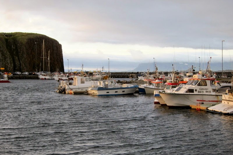
The
small town of Stikkisholmur (population
1,000) is a center for services and commerce in the western part of
Iceland. Most people here make their
living from fishing, though it gained some fame as the home of the world’s
oldest weather station, first manned in 1845.
 Stykkisholmur
is a typical small Icelandic fishing village in which many of the old houses have
been renovated. Except for its very modern church, the town is becoming a living
museum of historical houses. If the
wind ever stopped blowing, it would be a fine place to wander around … with 20+ hours of daylight in the summertime, there’s plenty of time for sight-seeing.
We
made time one evening for arts and crafts.
One of our fellow travelers was an expert in the art of origami, so we had a group lesson right
in the hotel lobby. We got some funny
looks from other folks, but we all came home with nifty little swans for show
and tell.
Exploring the Snaefellnes Peninsula was an all-day undertaking. The peninsula is dominated by the glacier-covered volcano at its center; most of the area is protected as a national park. It’s easy to see why Jules Vernes was drawn to this place – the dramatic mountain peak was torn apart when the volcano beneath the icecap exploded. The volcano subsequently collapsed, creating a huge caldera. Bare spots are clearly visible near the top of the glacier. The ice is melting rapidly and scientists predict that the glacier here will be gone by 2050.
Our
first stop was the beach near the abandoned farm of Ytri Tunga, for nice views of the mountain and seals sunning on the
rocks. The American Oystercatcher was a
bonus!


Driving
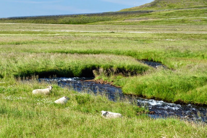
along the southern coast of the peninsula is simply beautiful. Lots of green fields, hay bales, sheep, steep
mountain ridges, and an occasional waterfall.


The Bjarnarfoss waterfall was viewed from a distance since the farm owner has had enough of tourists tramping all over his fields to admire the spectacle in his back yard.
Arnarstapi is an old fishing village nestled between cold arctic waters and massive tangles of lava. Today there are a few summer cottages in the area, as well as a large troll-like monument honoring Bardur, the region’s guardian spirit.

At
Arnarstapi, we left our bus and walked along the scenic 2 mile Coastal Trail to the little town of
Hellnar. This narrow trail follows the
jagged coastline, crossing through all manner of lava flows and dazzling views
along the way. Jo and Carol demonstrate
the costume of the day – it was bright and sunny, but cold and windy.


Hellnar is a picturesque spot, well worth the walk. Seabirds filled the air, as did the aroma of fresh fish soup at the tiny restaurant strategically placed at the end of the trail.
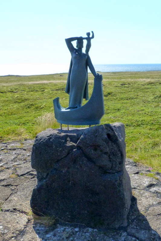
Lougarbrekka is the site of an old farm that dates back to the time of the Settlement. A statue here honors the first white woman to bear a child in America – an Icelander who was born here around 1000AD. Nearby, Malariff is a rocket shaped lighthouse situated on the most southern tip of the Snaefellnes Peninsula.
Londrangar –
rock pillars that surge up into the air like a frozen splash of lava. Locals say that elves use the lava formation
as a church.
Dritvik is a black-sand beach where about 60 fishing boats were stationed from the 16th to the 19th century. The black sands are littered with pieces of rusted metal from an English trawler that wrecked here in 1948.

Djupalonssandur is another black-sand beach, with dramatic rocky stacks emerging from the ocean.

On the shore there are four rocks of different sizes, on which folks tried their strength in olden times. Only the strongest were considered suitable for a life at sea.

After
a long day of exploring the peninsula, we stopped at Bjarnarhofn, a small farm with a big smell. The smell is rotting shark flesh – the farm
is the region’s leading producer of hakari,
a traditional Icelandic dish. The museum
here details the history of this local delicacy through displays of shark
fishing boats and tools and explanations of the fermenting process. Our visit included a taste of hakari, along with a piece of rye bread
and a shot of Brennivin to wash it
down. Brennivin is a potato-based, coriander-flavored schnapps known as
“Black Death.” Opinions varied about
which tasted worse, the fish or the drink, but nobody lined up for seconds of
either one.


Completing
our circle of the volcano, we stopped for one last waterfall – Kirjufellsfoss – and headed back to
Stikkisholmur.
There was still plenty of daylight left, so we hopped a boat for a cruise of Breidafjordur, the huge bay that separates the Snaefellsnes Peninsula from the looming cliffs of the distant Westfjords. Locals claim that it is impossible to count all of the craggy islets in the bay, but they do make for scenic vistas – lots of green and blue and loads of birds.

We saw nesting kittiwakes, cormorants and black-backed gulls.


And … we got our first look at puffins. They look a bit like cartoon characters – not the most graceful of birds, but surely the cutest.

A
drag-net behind the boat brought up a load of scallops, sea urchins and other
critters of the sea. Sushi time!


Leaving Stikkisholmur, we headed to the north coast of Iceland. We drove along a majestic coastline dotted with fjords, islands, mountain peaks and green valleys – beautiful scenery even on a cloudy day.


Leaving Stikkisholmur, we headed to the north coast of Iceland. We drove along a majestic coastline dotted with fjords, islands, mountain peaks and green valleys – beautiful scenery even on a cloudy day.

And
hay bales – there was a bumper crop
of hay this summer and we passed millions of round hay bales, tightly wrapped
to store for winter feeding. We thought
the white ones looked like marshmallow farms …
We
stopped at Eiriksstadir, the home of
Erik the Red, the father of Leif Eriksson, believed to be the first European to
visit America. Little remains of the
original farmstead, but there is a reconstruction of the crude turf house used
in earlier times. A period-dressed guide
showed us around and told the story of Erik the Red, who went on to found the
first European settlement in Greenland.


 We
had lunch and a nice visit at Gauksmyri,
a lodge and farm known for training Icelandic horses. The Icelandic
horse is a small but strong and muscular breed, sure-footed enough to
handle the island’s roughest terrain.
The Icelandic horse comes in many colors and is renowned for its five
gaits – walk, trot, gallop, flying pace, and the tolt. The tolt is a four-beat gait that is smooth,
easy and comfortable to ride.
We also said hello to the Icelandic sheep dog, which is a spitz type of breed originating from the dogs brought to Iceland by the Vikings. They are still commonly used to herd sheep in the Icelandic countryside.
Our last stop on this travel day was in the Oxnadalur Valley for a look at the mountain peak known as Hraundrangi. This 3500-foot spire is flanked by pinnacles of rock, making it one of the more dramatic roadside stops in our travels here.
NORTHERN ICELAND
Akureyi was our home base for travelling around the northern region of the island. This is Iceland’s second largest city, nestled at the base of snow-capped peaks at the head of Iceland’s greatest fjord. It was here that we enjoyed a home-hosted meal with a local family – good food and conversation – we always enjoy spending time with real people for a better feel of the culture and customs.
Akureyi was our home base for travelling around the northern region of the island. This is Iceland’s second largest city, nestled at the base of snow-capped peaks at the head of Iceland’s greatest fjord. It was here that we enjoyed a home-hosted meal with a local family – good food and conversation – we always enjoy spending time with real people for a better feel of the culture and customs.
We spent one day visiting the Lake Myvatn area, starting at the village of Reykjahlid, which was mostly destroyed by a lava stream when the volcano Krafla erupted in 1729. The inhabitants were saved when the lava flow stopped in front of the village church, allegedly as the result of the prayers of the local priest. The present building was constructed in 1972. Horses were grazing along the lake near the church.
Krafla’s eruption over 2000 years ago created Lake Myvatn and its surrounding landscape of volcanic landforms. Today its shoreline is dotted with small farms, lava fields, and pseudocraters formed by steam explosions.

We
stopped on the hillside for a quick look at Storra-Viti, a water-filled crater known as “Big Hell.” At an elevation of 900 feet, this 1000-foot
wide crater is only one of many vents along the Krafla central volcano. While
we were there, it started snowing, so we headed indoors to visit part of the
geothermal power plant nearby.
The Krafla power plant was started in 1975, but was quickly stopped when – after a rest of several hundred years - Krafla burst into activity in the first of nine eruptions that lasted over five years. You’d think they might reconsider the feasibility of a power plant in an active volcanic area? Think again. Once the volcano settled down, the project went forward and now produces enough electricity and hot water for towns and villages throughout the region.
There
have been other, less successful efforts to harness all this power. For example, farmers tried growing potatoes
near Krafla, but these often emerged from the ground already boiled. Today, Icelanders are proud to point out that
99% of their electricity comes from hydropower and geothermal power and over
80% of total energy consumption is from renewable sources. Only ships, boats,
cars and airplanes still use fossil fuel.
Down
the hill again, we stopped near the pastel-colored ridge known as Namafjall. It is flanked by Hverir, a lunar-like landscape of mud cauldrons, steaming vents,
colorful mineral deposits, and piping fumaroles. The stench of sulfur is powerful, but the
place is nonetheless magical.
Storagja and Grjotagja
are lava caves filled with hot water. Dennis
is standing near the steamy entrance to Grjotagja, where the water simmers at
about 115 degrees – a bit too warm for soaking.
Dominating the landscape near the lake is Hverfell, a nearly symmetrical crater that appeared after a major eruption some 2700 years ago. At 1500 feet high and 3400 feet across, it is an unmistakable landmark in the Myvatn area.
At its base is Dimmuborgir, a giant jagged lava field created when lava from two different volcanoes flowed across the older lava field of Hverfell. A domed lava roof formed over a pool of molten lava and then collapsed, leaving all sorts of pillars and strange shapes scattered across the landscape. With lots of criss-crossing trails, it was a good place for hiking (but it would be a heck of a place to get lost).
On
the way back to Akureyi, we stopped for walk around the waterfall named Godafoss.
Ripping through the lava fields, this is not Iceland’s largest or
most powerful waterfall, but it is definitely one of the most beautiful. The falls play an important part in Icelandic
history. In the year 1000, Iceland’s
leader (the law speaker) declared the country a Christian nation – on his way
home, he passed this waterfall near his farm and tossed in his pagan carvings
of the Norse gods. Thereafter, the falls
were known as Godafoss, the Waterfall of the Gods.

Every
summer 9-11 species of whales are sighted in this area, ranging from the tiny
harbor porpoise to the giant blue whale. There are few places in the world with so many
species to be found. Humpback
whales are the first to arrive and that’s what we saw in our time on the
bay. A couple of times, we saw two whales together - impressive!
With
or without whales, it was a beautiful day to be out on the water – a bit nippy,
but sunny and clear. Here Margaret, Vicky,
Dennis, Debbie and Doris soak up the sights.
As
we headed back to shore, the crew passed out fishing gear and most folks took a
turn at trolling for cod. The crew
cleaned the fish off the side of the boat, much to the delight of the sea birds
who were quick to grab a snack.

 As
soon as we landed, one of the crew was off the ship and headed to the grill. He fired it up, laid out our catch, and we
had a nice little feast on very fresh fish – delicious!
Hard to top a morning of whales, but how about an afternoon of herrings? We headed over to Siglufjordur, a charming town sitting precariously at the foot of a steep slope overlooking a beautiful fjord. Siglufjordur once was known as the herring-fishing capital of Iceland.
 In its heyday, fishing boats crammed into the town’s small harbor, and some 10,000 workers were involved in the herring industry – catching, unloading, cleaning and salting fish. We arrived just in time for the annual Herring Festival and enjoyed watching the women gut, salt and pack herrings in barrels – just like in the old days.

 As
soon as we landed, one of the crew was off the ship and headed to the grill. He fired it up, laid out our catch, and we
had a nice little feast on very fresh fish – delicious!
As
soon as we landed, one of the crew was off the ship and headed to the grill. He fired it up, laid out our catch, and we
had a nice little feast on very fresh fish – delicious!Hard to top a morning of whales, but how about an afternoon of herrings? We headed over to Siglufjordur, a charming town sitting precariously at the foot of a steep slope overlooking a beautiful fjord. Siglufjordur once was known as the herring-fishing capital of Iceland.

 In its heyday, fishing boats crammed into the town’s small harbor, and some 10,000 workers were involved in the herring industry – catching, unloading, cleaning and salting fish. We arrived just in time for the annual Herring Festival and enjoyed watching the women gut, salt and pack herrings in barrels – just like in the old days.
The
Herring Era Museum recreates the
town’s boom days between 1903 and 1968.
Set in several buildings that were part of an old Norwegian herring
station, the museum is packed with memorabilia, equipment and gadgets used in
the herring business.
SOUTHERN ICELAND
We
flew south for the last days of our visit.
There are not many towns along the south coast, but there are plenty of
mountains, volcanoes, glaciers and just stunning scenery.
Our
base of operations was the town of Hveragerdi,
which sits on top of a highly active geothermal field. The town has steaming earth all over – some
of it is harnessed to heat hundreds of greenhouses; some of the steaming pools
and mud pots are part of the town’s geothermal park (surely a unique public
park!). The visitor center includes an
earthquake simulator, where we got a feel for the 6.3 quake that hit this area
in 2008.
 Hekla,
meaning ‘Hooded One,’ is one of Iceland’s most active volcanoes. Its 5000-foot summit is almost always
shrouded in ominous looking clouds.
Hekla has vented its fury numerous times throughout history – in the
Middle Ages it was thought to be the gateway to hell. The most recent eruption was in 2000, and
locals live in constant fear that it will blow at any minute. We kept a respectable distance from this one
…
While
Icelanders worry about Hekla, just down the road is Eyjafjallajokull, the volcano known to the whole world for its
clouds of ash which wrecked air travel in 2010.
Locally, the volcano caused extensive flooding as its glaciers melted
and covered everything with muddy ash.
This picture shows a family farm near the base of the volcano – they dug
out and resumed business as usual – until the next time …
Skogafoss is a 200-foot waterfall that tumbles over a mossy green cliff near the village of Skogar. The foot of the falls is shrouded in sheets of mist and rainbows, making it hard to find the chest of gold said to be hidden behind the waterfall.
Myrdalsjokull is Iceland’s southernmost and fourth-largest glacier; it covers over 270 square miles and reaches a thickness of 2400 feet. Solheimajokull is one of its many outlets (or tongues) leading from the ice cap high in the mountains. We had a notion to go hiking on this glacier, but that didn’t happen because the glacier was undergoing changes deemed to be unsafe – a lagoon had formed at the tip of the glacier, icebergs were breaking off with some frequency, and noxious fumes were leaking out from underneath. (Now we know why this is known locally as ‘Stinking Glacier.’)

The volcano Katla snoozes beneath the Myrdalsjokull glacier, periodically blasting up through the ice to cover the coastal plain with a deluge of meltwater and fragments of volcanic rock and lava. Of all the volcanoes in Iceland, it is Katla that will probably cause the most trouble – there are 2-30 earthquakes in its caldera every day. When it blows, its eruption is expected to be followed by days of poisonous ashfall, clouds of volcanic materials and lightning strikes, followed by flash floods caused by the sudden melting of glacial ice.

The edge of the glacier is mostly black from grinding its way through rock and lava. It is hard not to be in awe of the force of nature at work here.


Back at the coast, we went to the top of an ocean-front cliff known as Reynisfjall. At 1200 feet high, it offers nice views along the coast. The most famous sight is a cluster of sea stacks known as Reynisdrangur, which rise from the black sand beach below.
Also visible is the rocky plateau and stone sea arch at Dyrholaey, which rises dramatically from the surrounding plain. This is the southernmost point on the island that is Iceland.
Our favorite view was just a bit closer, but harder to see – on the basalt cliffs beneath our feet were nests of puffins.

Seljalandfoss
is a beautiful high waterfall that flows over a rocky cliff into a deep green
pool. It’s perfect for romantics who
dream of walking behind waterfalls – a wet, slippery path runs around the
back while sheep wander around wondering what all the fuss is about.


As we headed back to Reykjavik, we stopped at the Hellisheidi Power Plant. It is the largest geothermal power station in the world, churning out electricity and hot water for Reykjavik and surrounding areas. It uses geothermal steam extracted from deep wells in the middle of a lava field in one of the most powerful geothermal areas in the world with several thousand hot springs at the surface and a giant magma chamber lying underground. Sounds risky, but over one-quarter of the island is considered an active volcanic zone, and these Icelanders are very serious about renewable and sustainable energy. Reykjavik has been recognized as Europe’s cleanest city for the past 10 years – only cars, boats and trains use carbon-based fuels, and that too is changing.
A note about all that hot water: it is used for heating home and filling pools
and hot tubs, as well as being piped under parking lots, roads and sidewalks to
prevent snow accumulation in winter.
Apart
from space heating, one of Iceland's oldest and most important usages of
geothermal energy is for heating greenhouses. While naturally warm soil has
long been used for growing potatoes and other vegetables, greenhouses are
becoming big business for production of vegetables and flowers. With the addition of electric lighting, the
growing season never ends. We visited Espiflot, a family-owned greenhouse that specializes in cut flowers,
particularly gerbera daisies, roses, mums and lilies. Many greenhouses now specialize in growing
vegetables – Iceland’s growing season is very short and importing fresh fruits
and vegetables is very expensive.


